
Drone flight & Analysis
We will survey with drone, process the data, and analyze forest information.
STEP01 Meeting
We discuss the purpose and the area of survey.
STEP02 Drone Flight
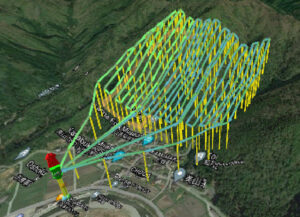
We create a flight route that follows the detailed terrain in advance, and take images while keeping a safe altitude and a enough quality of images.
STEP03 Image Processing
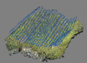
We build three dimensional forest model by merging a large number of acquired images and create a high-resolution image that provides a bird's-eye view of a wide area of forest from above.
STEP04 Detecting trees and estimating species, stem volume, etc.
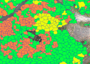
Tree Detection |
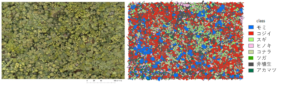
Tree species classification |
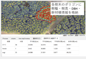
Size estimation |
 |
 |
 |
|
Based on the image information and 3D information, we detect the top and the boundary of individual trees using out original technology. This makes it possible to determine the number and density of each tree and perform subsequent analysis. |
Detailed tree species classification is performed using patent-pending deep learning technology. Coniferous trees such as cedar and cypress can be identified with more than 90% accuracy. | We estimate height, thickness (DBH), and stem volume for each tree. Crown area, tree species, and tree height information are used for thickness estimation. |
It can also classify broad-leaved trees in the world's top-level performance.
OPTION Quality Verification
We conduct on-site surveys to verify the accuracy of estimation.
At the same time, we also perform highly accurate estimation based on on-site data.
STEP05 Report
Report includes orthoimages, 3D data, and polygon data containing information on each tree in a format compatible with GIS.