Close
Skip to content
Business Contents
service
Smart Forestry Business
Business content
“A world where anyone can manage forests using drones”

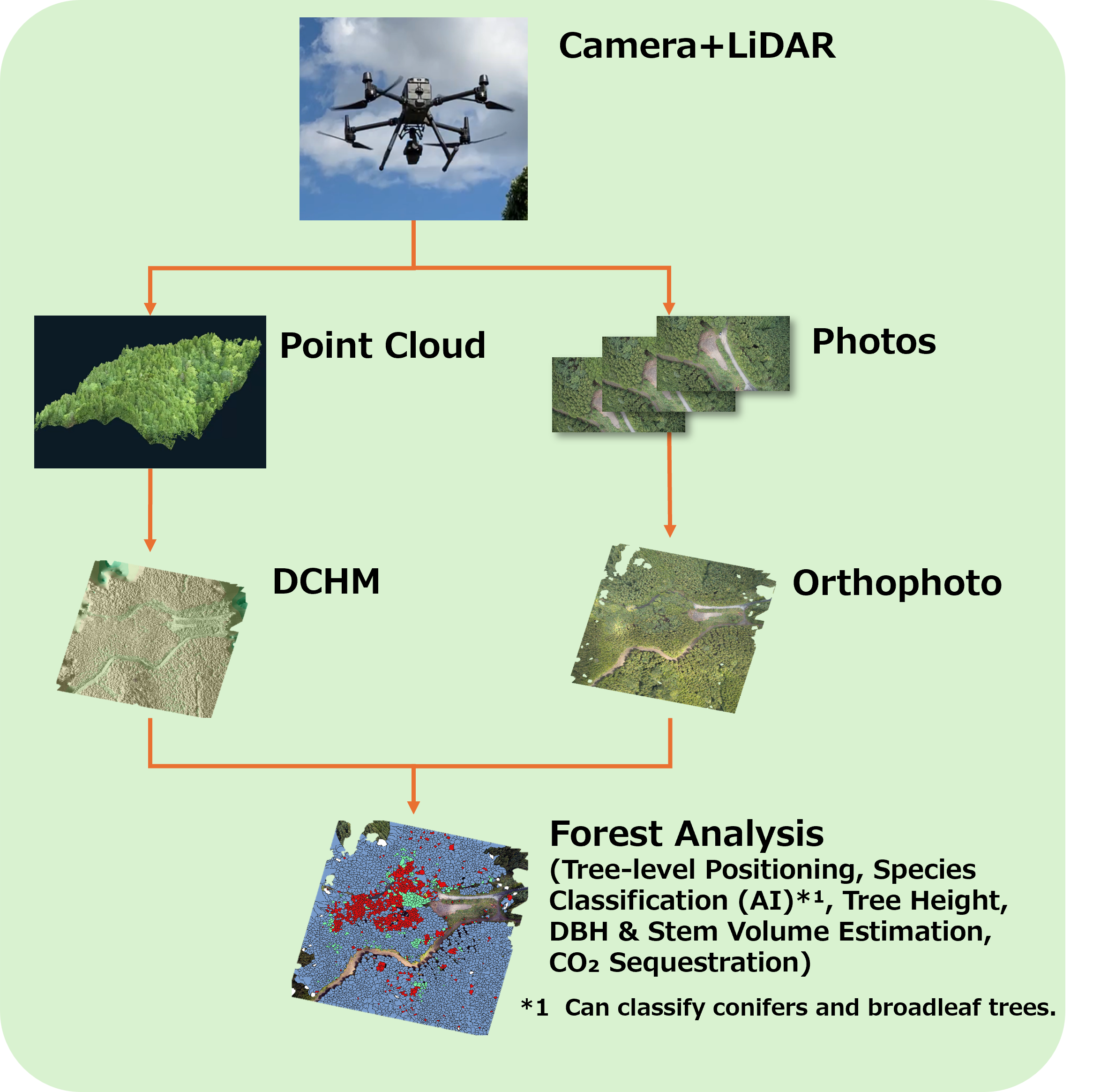
We handle everything from drone flight to forest analysis.
We have set up a system to implement it all at once.

In the future, anyone can easily own a drone.
Aiming for a world where forest surveys can be carried out,
Including technical lectures on drone operation, etc.
Creating various types of support.

Smart Forestry
Drone Business
Equipment List
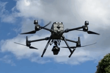
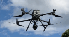
Matrice350 RTK & Zenmuse L1/L2 (Camera + LiDAR)
matrice
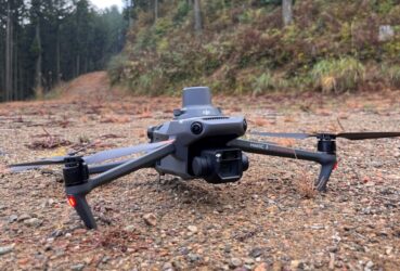
Mavic3 Enterprise RTK (Camera only)
mavic
Forest Resource Assesment
カメラ計測_en
カメラ計測_mobile_en
カメラ+レーザー計測_en
カメラ+レーザー計測_mobile_en
Use Cases
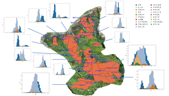
■ Visualization of Forest Conditions, Volume Estimation, and Species Diversity
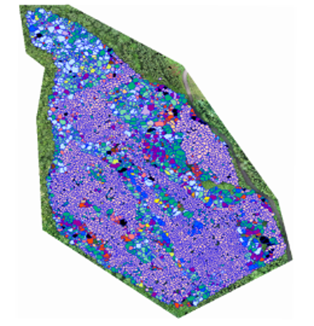
The drone measurement data will be used to create forest resource distribution and tree species maps. Advanced analysis technology using AI will make it possible to check detailed forest conditions at the individual tree level on a computer.
Smart Forestry
Smart Forestry
■ Pest and Disease Control
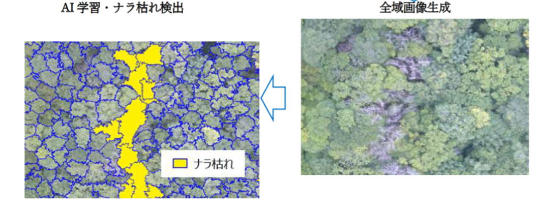
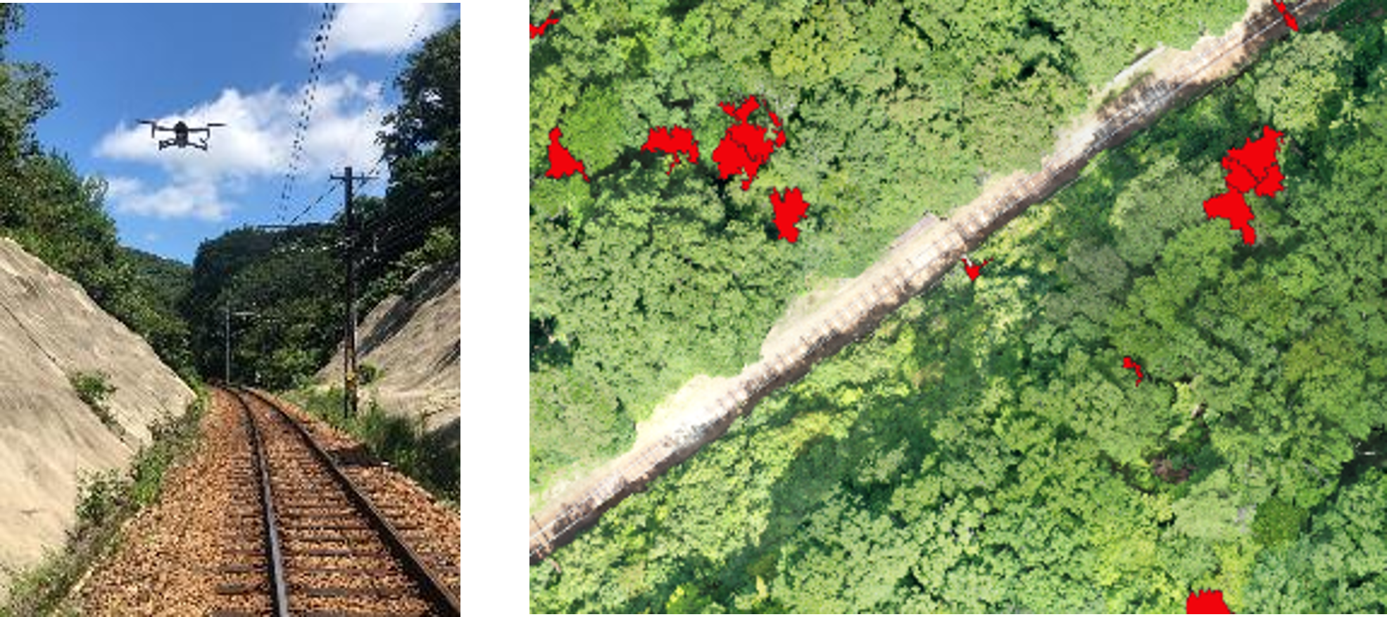
The drone measurement data can be used to identify the amount and location of dead trees that have been damaged by pests and diseases such as oak wilt. This can significantly reduce the amount of work required for on-site surveys to grasp the extent of damage and estimate the cost of felling work. It is also being increasingly used to deal with fallen tree damage along railway tracks.
Smart Forestry
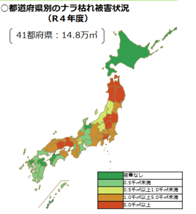
Status of Oak Wilt Damage by Prefecture in Japan
Source: Forestry Agency of Japan website – https://www.rinya.maff.go.jp/j/hogo/higai/attach/pdf/naragare_R5-3.pdf
Case 1: Oak Wilt Detection Using AI
Smart Forestry
Case 2: Dead Tree Detection Along Railway Tracks
Smart Forestry
■ High-Precision Terrain Data  (When using LiDAR measurement)
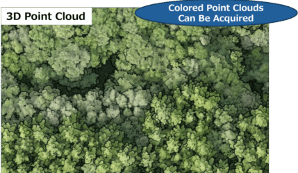
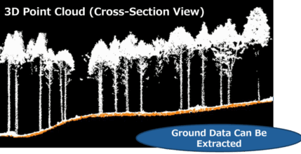
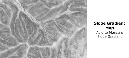
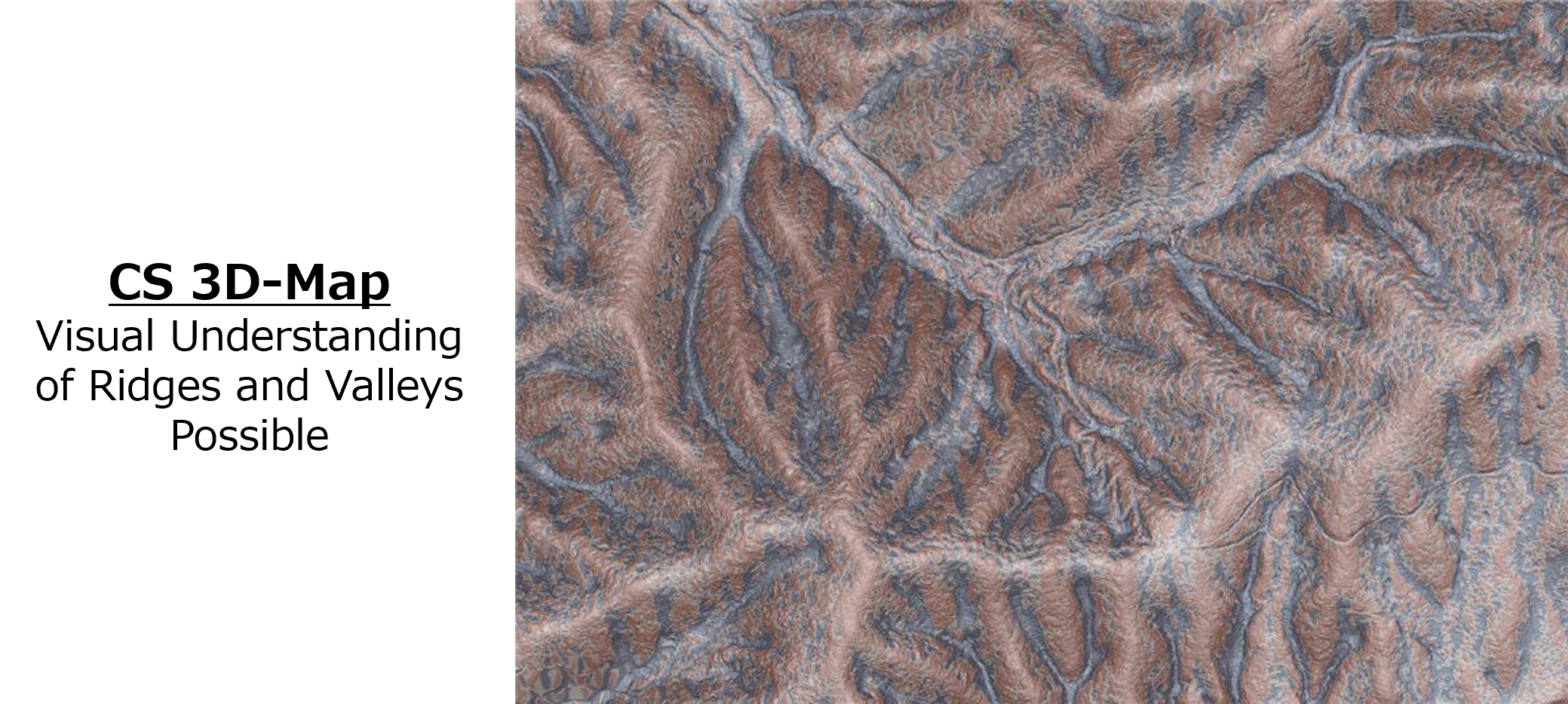
High-Precision Terrain Data such as slope gradient maps and CS 3D-Maps are created from the 3D point cloud data acquired by the LiDAR drone. Used for boundary clarification, detailed forest road design, selection of forestry machinery routes, etc.
3次元点群_en
3次元点群-断面表示_en
傾斜量図_en
CS立体図_en
Drone Photography & Analysis
We perform drone photography, data processing, and forest information analysis.
STEP 01

Preliminary Checks / Planning

Formulation of measurement plan
We will discuss the purpose and the area to be photographed.

● Preliminary Checks
・Confirmation of target area and terrain conditions
・Verification of flight permission requirements, etc.

● Planning
・Drone selection
    – Type: Camera-only or camera with LiDAR
    – RTK positioning: Enabled / Disabled
・Flight and survey planning
matrice

Matrice350 RTK
LiDAR:Zenmuse L1/L2

mavic

Mavic3 enterprise RTK

STEP 02
doron

Drone Flight

Autopilot based on measurement plan
Perform contour flight

The drone flies according to the terrain.
A flight route that follows detailed terrain is created in advance using special software, and images are taken safely while maintaining a constant altitude and image quality.

Smart Forestry

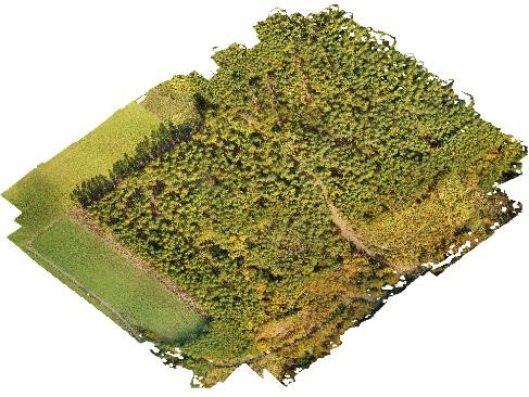
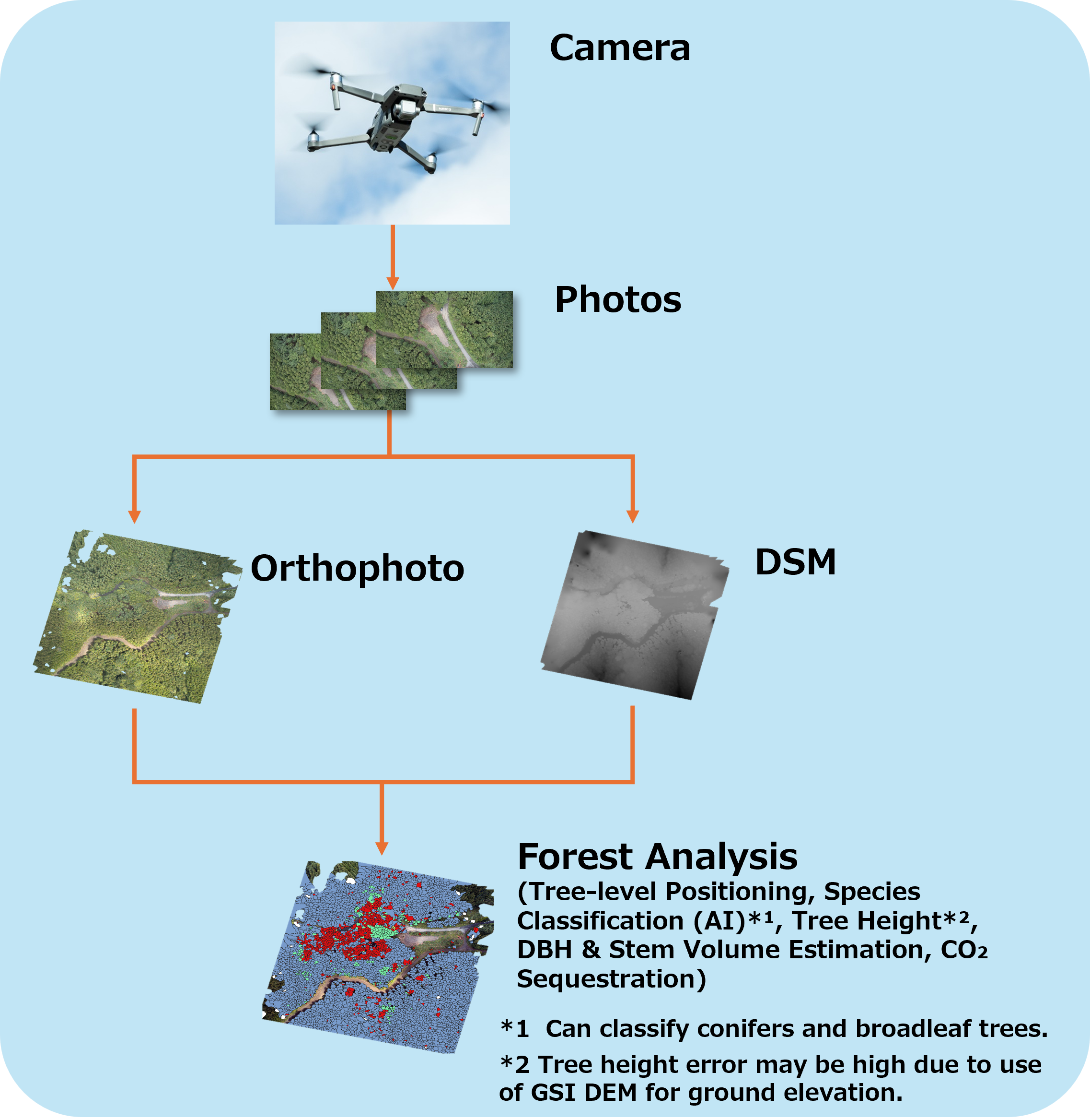
Reproducing a forest from images using image processing

By combining the many images obtained, the forest is
recreated in three dimensions.
Creates a high-resolution image that provides a bird’s-eye view
of a wide area of ​​forest.

● Data processing for analysis
・Creation of ortho/DSM images using SFM technology
・Creation of DTM images by filtering processing
  (During laser measurement) DF LAT
Orthomosaic
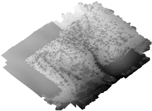
Orthomosaic

DSM

DSM

DTM

DTM

STEP 03
Smart Forestry

Creating Data for Analysis

Separate individual trees based on images
Determine the number, type, volume, etc.

Add the following analysis results to the attribute information.
It is possible to output in Shape file format (GIS standard format).
OPTION Quality Assurance
Conduct an on-site survey to find out how accurate it actually is
Verify the accuracy of the size estimation.。
At the same time, highly accurate estimates are made based on local data.

OPTION Quality Assurance
Conduct an on-site survey to find out how accurate it actually is
Verify the accuracy of the size estimation.。
At the same time, highly accurate estimates are made based on local data.

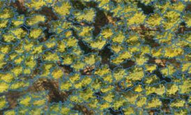
Tree Crown Segmentation

Tree Crown Segmentation

Unique technology based on image information and 3D information
to detect the tree top and the range of individuals.
This allows us to understand the number and density of each tree,
Subsequent analysis is possible.
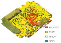
Tree Species Identification

Tree Species Identification

We perform detailed tree species identification using deep learning using patent-pending technology.
Coniferous trees such as cedar and cypress have over 90%
Can be identified with precision.
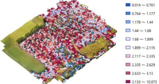
Size Estimation

Size Estimation

The tree height, thickness (DBH), and trunk volume are estimated for each tree.
Tree crown area, tree species, and tree height information are used to estimate the thickness.

It is also capable of identifying hardwoods, boasting world-class identification performance.
STEP 04
Smart Forestry

Report / Delivery

We will report the results and deliver the results.
The delivered items included orthoimages, 3D data, and information about each tree.
We deliver polygon data in a format compatible with GIS.


CONTACT
Copyright © DeepForest Technologies All Rights Reserved.