
Close
Skip to content
DF LAT
Desktop application for LiDAR data analysis
DF LAT
Desktop application for LiDAR data analysis
DF LAT (DeepForest LiDAR Analysis Tool) is software designed to generate data for forest analysis, including detailed topographic maps and canopy height data, from point cloud data obtained by drone-mounted LiDAR technology. 
DF LAT takes LAS files from laser data and automatically detects ground and vegetation, creating high-resolution data at a 5cm resolution, including a Digital Terrain Model (DTM), Digital Surface Model (DSM), and Canopy Height Model (CHM). This allows for obtaining high-resolution topographic maps that capture forest trails and micro-terrain features and high-resolution canopy height models that can distinguish individual trees. 
The data generated by DF LAT can be used in conjunction with the forest analysis software DF Scanner, enabling the detection of individual trees, tree species identification, and estimation of tree height and timber volume for each tree.
DF LAT
Ground detection
The software can also automatically detect the ground beneath the trees from the laser data obtained by the drone, allowing for a comprehensive analysis of the forest, including the ground beneath the trees.
DF LAT
Manual filtering
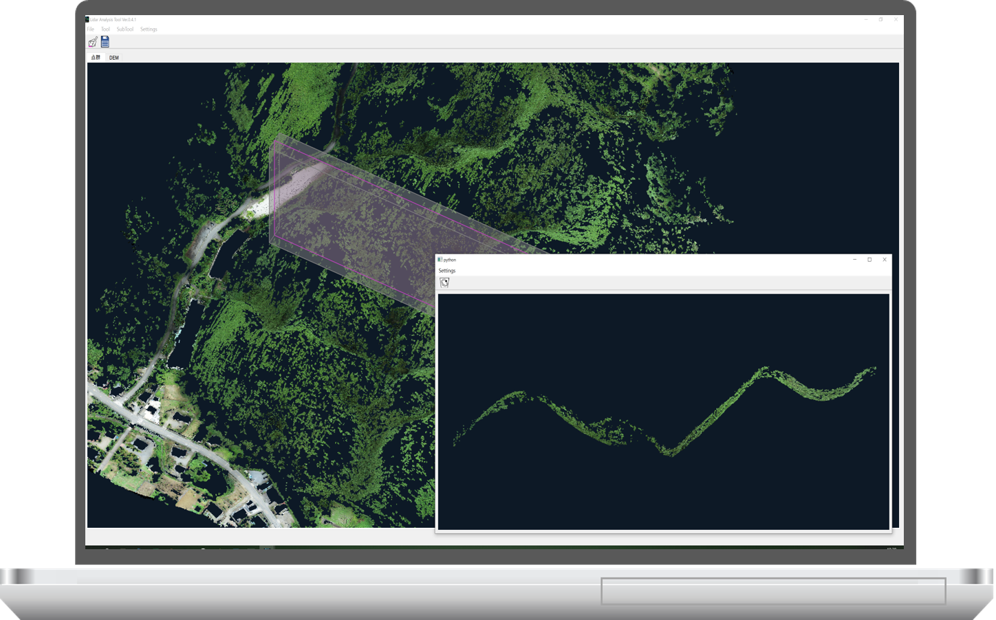
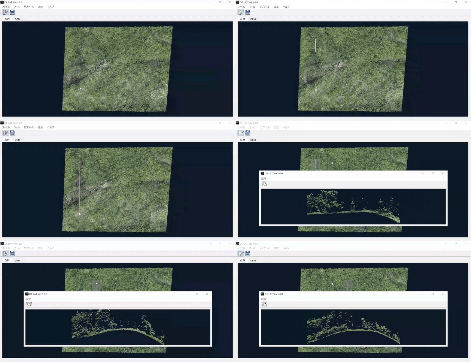
You can draw lines on the screen to create cross-sectional views, which can be viewed in a separate window. This feature allows you to manually remove points from the point cloud data as needed.
DF LAT
By drawing a line at the location where you want to view a cross-section, a separate window will display the cross-sectional part. You can use the mouse scroll to view cross-sections of adjacent areas.
DF LAT
Creation of raster data
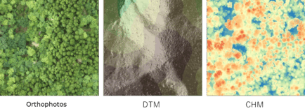
It is possible to create DSM, DTM, and CHM in geotiff format (.tif) from the original point cloud data and ground point cloud data. You can choose the output resolution as well as whether to perform point cloud interpolation during DTM creation. The default resolution is set to 5cm. The DTM and other data created can be visualized as shaded relief maps in DF LAT, allowing you to check for any remaining noise or anomalies.
ortho-dtm-chm
Product Price
DF LAT Subscription License
Domestic Price (Japan), including tax
Target Plan Annual Monthly
General Users Pro
JPY 1,100,000 / year
JPY 220,000 / month
Lite
JPY 495,000 / year
JPY 110,000 / month
Forestry Businesses Pro
JPY 495,000 / year
JPY 110,000 / month
Lite
JPY 220,000 / year
JPY 55,000 / month
Educational/Research Institutions Pro
JPY 220,000 / year
JPY 55,000 / month
Lite
JPY 220,000 / year
JPY 55,000 / month
Target Plan Annual Monthly
General Users Pro
JPY
1,100,000
JPY
220,000
Lite
JPY
495,000
JPY
110,000
Forestry Businesses Pro
JPY
495,000
JPY
110,000
Lite
JPY
220,000
JPY
55,000
Educational/Research
Institutions
Pro
JPY
220,000
JPY
55,000
Lite
JPY
220,000
JPY
55,000
DF LAT Perpetual License
Domestic Price (Japan), including tax

Only Lite version

JPY 880,000  

(Annual maintenance fee after the first year: JPY 88,000 per year)

For Overseas Pricing

Please contact us.

Pro vs Lite Feature Comparison Table
Features DF LAT Pro*1 DF LAT Lite*1
Point Croud Rendering
DSM,DTM rendering
Auto Filtering(Ground Detection)
Manual Filtering
Point Clouds Classification ×
DSM,DTM,CHM creation
Full Automatic Processing
Convert CRS ×
Data Division/Merge ×
Laser Forest Map Creation
CS Topographical Map

*1  DF LAT supports LAS format (.las) version 1.2 or later.

DF LAT System Requirements
  Required Recommended
OS Windows 10 Windows 11
 RAM 4GB 16GB or more
Free Disc Space 7GB 10GB or more
GPU
CONTACT
Copyright © DeepForest Technologies All Rights Reserved.